Potřebujeme váš souhlas k využití jednotlivých dat, aby se vám mimo jiné mohly ukazovat informace týkající se vašich zájmů. Souhlas udělíte kliknutím na tlačítko „OK“.
ČSN EN ISO 19123-1 (979842)
Geografická informace - Schéma pro geometrii a funkce pokrytí - Část 1: Základy (Norma k přímému použití jako ČSN).
Přeložit název
NORMA vydána dne 1.12.2023
Informace o normě:
Označení normy: ČSN EN ISO 19123-1
Třídící znak: 979842
Katalogové číslo: 517997
Datum vydání normy: 1.12.2023
Kód zboží: NS-1159545
Počet stran: 94
Přibližná hmotnost: 313 g (0.69 liber)
Země: Česká technická norma
Kategorie: Technické normy ČSN
Kategorie - podobné normy:
Anotace textu normy ČSN EN ISO 19123-1 (979842):
This document defines a conceptual schema for coverages. A coverage is a mapping from a spatial, temporal or spatiotemporal domain to attribute values sharing the same attribute type. A coverage domain consists of a collection of direct positions in a coordinate space that can be defined in terms of spatial and/or temporal dimensions, as well as non-spatiotemporal (in ISO 19111:2019, "parametric") dimensions. Examples of coverages include point clouds, grids, meshes, triangulated irregular networks, and polygon sets. Coverages are the prevailing data structures in a number of application areas, such as remote sensing, meteorology and mapping of depth, elevation, soil and vegetation. This document defines the coverage concept including the relationship between the domain of a coverage and its associated attribute range. This document defines the characteristics of the domain. The characteristics of the attribute range are not defined in this document, but are defined in implementation standards. Consequently, the standardization target of this document consists of implementation standards, not concrete implementations themselves
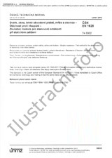
Náhled normy ČSN EN ISO 19123-1 (979842)
Odebírejte informace o nově vydaných normách ZDARMA:
Chcete pravidelně odebírat informace o nově vycházejících normách z celého světa a to zcela zdarma?
Přihlašte se k odběru. Vše je velice jednoduché a absolutně ZDARMA.
Na výběr máte vydavatele z celého světa.


 Cookies
